Scenic Byway 12
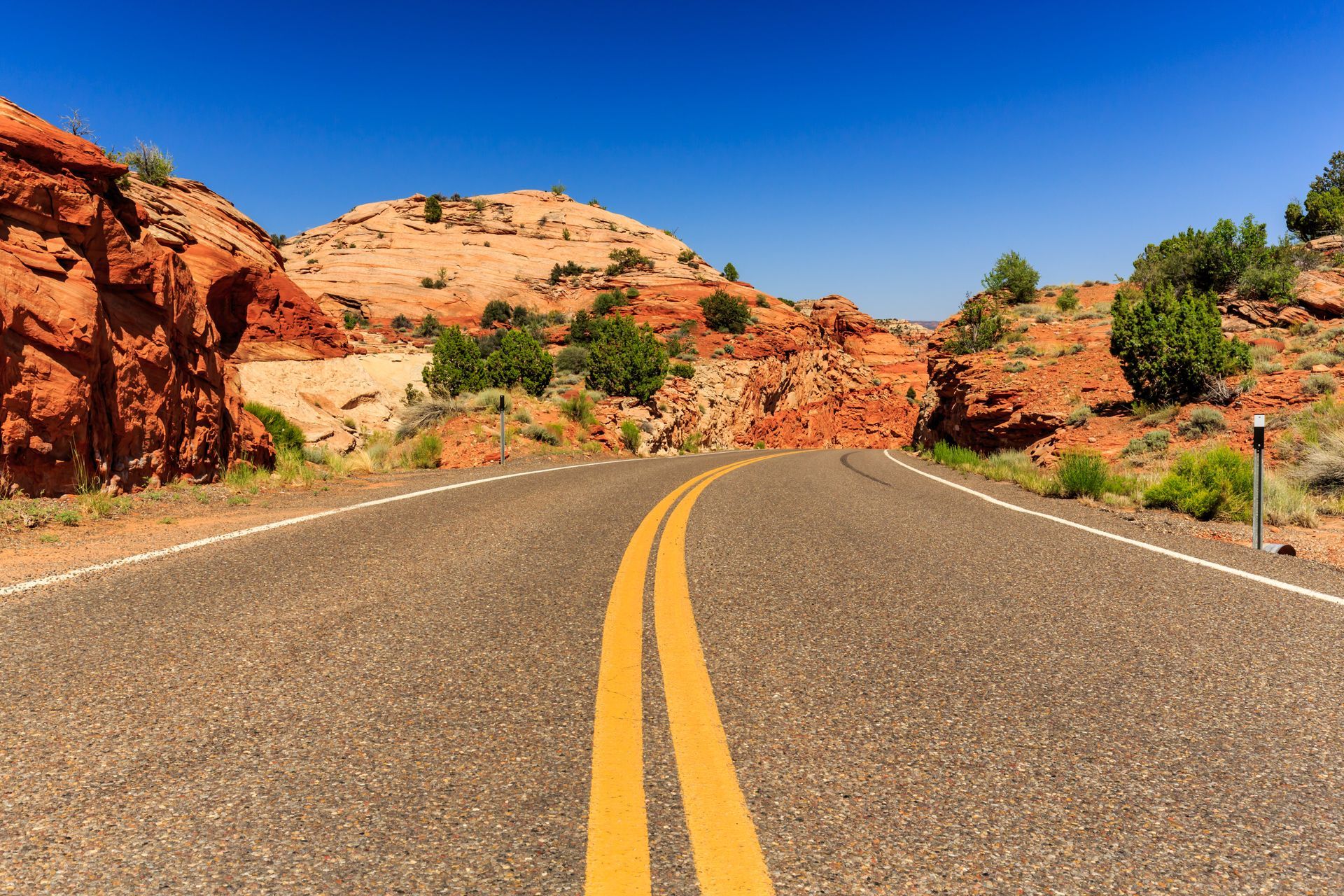
Those who consider life a journey will relish the beautiful excursion along Utah’s Scenic Byway 12, and that is an understatement. The nearly 124 mile byway spans an area with three national parks, three state parks, a national recreation area, and a national monument. These are some of the reasons why Car and Driver magazine considers it a spectacular roadway.
There is so much to do along Scenic Byway 12. Geology buffs will enjoy the grandeur of the Grand Staircase while history buffs will enjoy the Indian and pioneer heritage here. Visitors can also view the terrain via air, ATVs, horseback, bikes, and by foot on hundreds of trail miles. Please note that many of the unpaved roadways are unsuitable for travel when wet. Also, flash floods are a real danger in slot canyons whether it is raining in the immediate vicinity or even several miles away.
Stops along Scenic Byway 12
PETROGLYPHS AND PICTOGRAPHS
Petroglyphs and pictographs reveal Indian history. Petroglyphs are pecked on walls while pictographs are painted on walls. For those interested in natural history, these are a must-see.
DIXIE NATIONAL FOREST
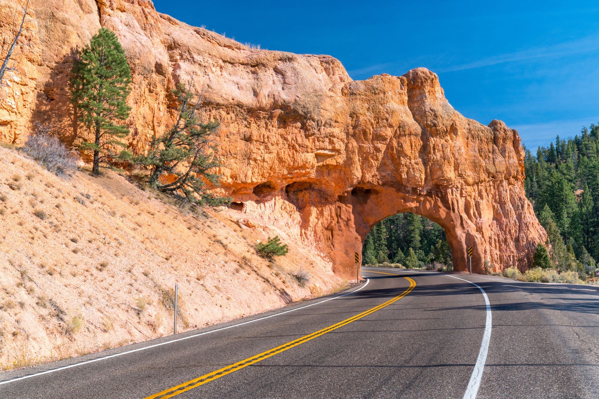
Dixie National Forest spans an area from the border of Nevada to Capitol Reef National Park. A highlight of this forest is Red Canyon, and there are also several trails on which visitors can explore.
BRYCE CANYON NATIONAL PARK
Bryce Canyon National Park has red pinnacles and spires surrounded by pine trees that captivate visitors. The visitor center has an award winning video program and museum.
POWELL POINT
At 10,188 feet above sea level Powell Point served as a great landmark for Major John Wesley Powell’s late 1800s expeditions in the area. Likewise, it provides spectacular views for the modern-day visitor.
GRAND STAIRCASE ESCALANTED NATIONAL MONUMENT
Grand Staircase Escalante National Monument – click here to learn more.
KODACHROME BASIN STATE PARK
Kodachrome Basin State Park filled with many geysers of stone. These geysers blasted through sediment of an ancient lake-bed, and harder sediment later filled the vertical tubes created by the geysers. As softer sediment eroded away it left the geyser tubes of stone.
ESCALANTE PETRIFIED FOREST STATE PARKS
This area is open to campers year round. Wide Hollow Reservoir provides great opportunities for fishing, boating, and swimming. Of course, petrified wood from millions of years ago is strewn throughout the area. Services, lodging, and public and private campgrounds are in Escalante. It also offers barbecue and picnic areas along with rentable canoes courtesy of the state park. The state park rents canoes.
POSEY LAKE
Posey Lake is accessible Posey Lake Scenic Backway. Fishing, hiking, mountain biking, and other activities are available in the picturesque area around the lake.
HELL'S BACKBONE ROAD
Hell’s Backbone Road is dramatic as it has steep drop-offs on both sides of the road. This stretch of road will offer travelers excitement – and many photo-ops – while they enjoy spectacular views of the Box-Death Hollow Wilderness Area.
HOLE-IN-THE-ROCK ROAD
Hole-in-the-Rock Road is a 70 mile graded road that provides access to Devils Garden, Dance Hall Rock, the Escalante Canyons, and ultimately to Hole-in-the-Rock. In the 1880s this area provided many obstacles for the Mormon settlers. Traveling this route was originally meant to take just two weeks but took six months to complete.
DEVIL'S GARDEN
Many consider Devils Garden to be a little wonderland full of nature’s enchantment of arches and unique rock formations. Hikers will enjoy this area that offers many challenging treks on slick-rock.
HEAD OF THE ROCKS AND ESCALANTE CANYONS
The “Million Dollar Road to Boulder” section of Scenic Byway 12 leads to Head of the Rocks and Escalante Canyons. This section provides an interesting history for the area. Due to the ruggedness of the Escalante Canyons area, mail was carried in this area by mule until the early 1970s.
CALF CREEK RECREATION AREA
Calf Creek Recreation Area provides an excellent treat for travelers – a gorgeous 126 foot water fall and grotto. This is a perfect place to wade through a creek and relax, especially during the summer.
THE HOGSBACK
The Hogsback (part of Scenic Byway 12) offers dramatic views from a narrow road that follows the spine of a dramatic sandstone ridge. Here cliffs roll off on both sides of the road for over 1,000 feet. The road is well paved with turn-outs for viewing areas.
BURR TRAIL
Burr Trail is a former cattle drive route. Travelers on this trail will enjoy scenery as it meanders through Grand Staircase Escalante National Monument, Capitol Reef National Park, and Glen Canyon National Recreation Area.
ANASAZI STATE PARK MUSEUM
Anasazi State Park Museum takes visitors back thousands of years to the time when the Fremont and Anasazi civilizations lived here. At one time approximately 200 Indians lived right on the site where the museum is presently located.
BOULDER MOUNTAIN
Boulder Mountain is part of the Aquarius Plateau — the highest forested plateau on the continent. It also provides awe inspiring views of the sites over 100 miles away like the Henry Mountains and Navajo Mountain.
CAPITOL REEF NATIONAL PARK
Early pioneers in the area named this area Capitol Reef National Park because of its many domes that reminded them of the Nation’s capitol. One of the major formations within park is the expansive Waterpocket Fold that spans about 100 miles.
ESCALANTE, UTAH
Escalante, Utah is called the “Heart of Highway 12.” Formerly known as Potato Valley because of its wild potatoes, it was later renamed after Silvestre Velez de Escalante, a Franciscan priest, who led the first exploration in the area in 1776.
BOULDER, UTAH
Boulder, Utah was settled in 1889, but it is the last town in the United States to stop receiving mail by mule in the early 1970s. These mules were literally butter makers since the milk and cream that they carried became butter along the rough path that they traveled before Scenic Byway 12 was completed.