YOUR GUIDE TO THE AREA
Discover Escalante
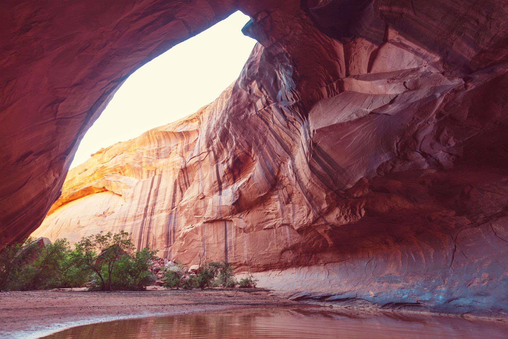
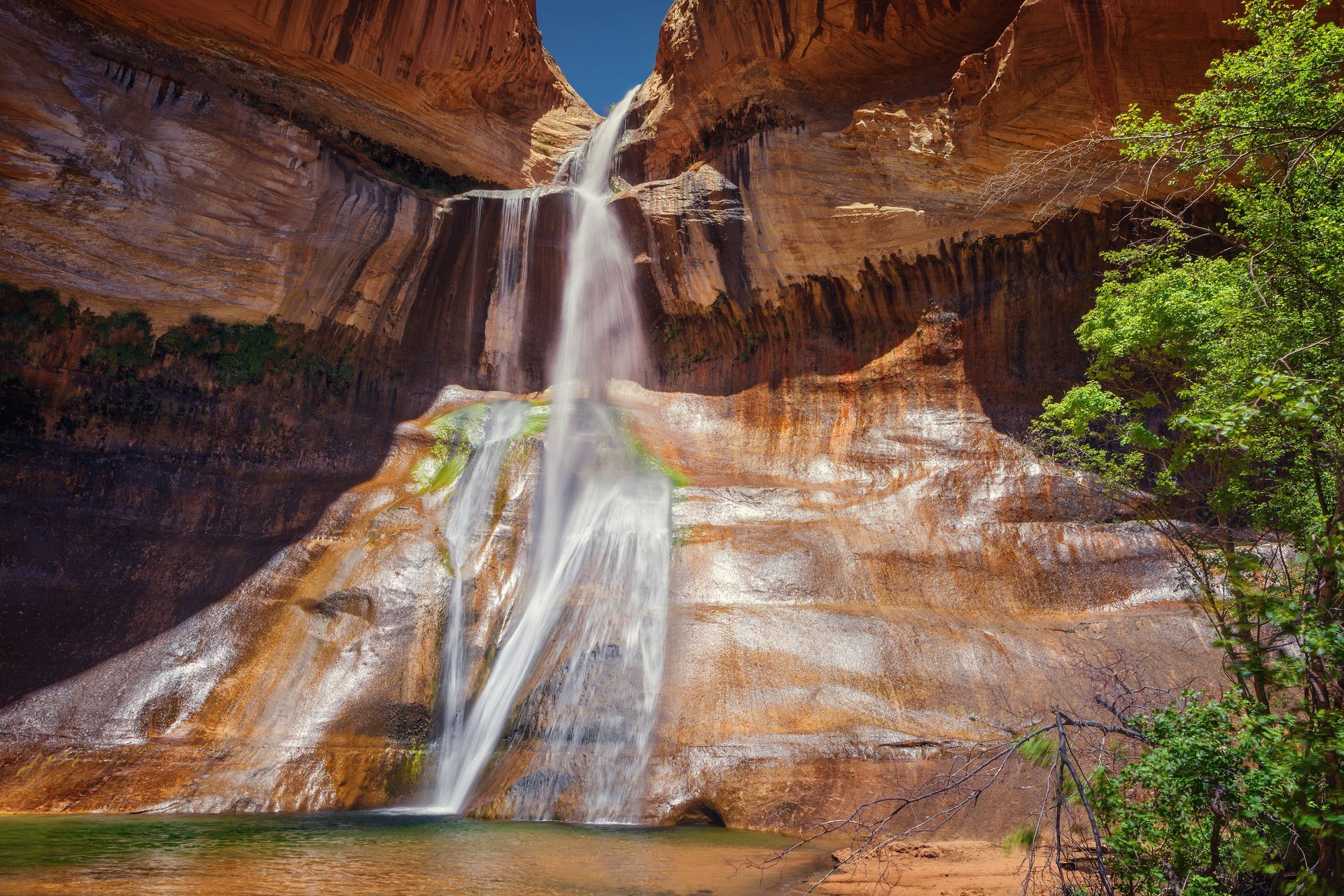
Lower Calf Creek Falls
One of the most iconic and rewarding hikes in Southern Utah, Lower Calf Creek Falls leads visitors through a spectacular desert canyon to a breathtaking 126-foot waterfall. The trail follows Calf Creek, winding past colorful sandstone cliffs, ancient Fremont cultural sites, and lush vegetation rarely found in the desert. At the end of the hike, a beautiful waterfall cascades into a cool pool, providing a refreshing destination on warm days and an unforgettable experience for hikers of all ages.
Distance: 6 miles round trip. Allow for 3 to 5 hours to complete.
Difficulty:
Moderate
- What to Bring:
- Plenty of water (at least 2 to 3 liters per person)
- Sturdy hiking shoes with good traction
- Sun protection (hat, sunglasses, and sunscreen).
- Snacks or a packed lunch.
- A camera or smartphone for photos
- Swimsuit and towel if you plan to enjoy the pool beneath the falls.
- Lightweight layers for changing weather conditions.
Safety Precautions:
- There is very little shade along much of the trail. Start early during hot weather and carry plenty of water.
- Stay on the designated trail to protect fragile desert vegetation and archaeological resources.
- Watch children carefully near cliff edges and around the waterfall pool.
- Rocks near the waterfall can be slippery.
- Swimming is permitted, but the water remains cold year round.
- Summer temperatures can be in the high 90s making dehydration and heat exhaustion serious concerns.
Getting There:
The trailhead is located between Escalante and Boulder on the Scenic Byway 12 within the Calf Creek Recreation Area. A paved parking lot, restrooms, a campground, and a picnic area are at the beginning of the trailhead. The recreation area is approximately 15 miles east of Escalante and 11 miles west of Boulder.
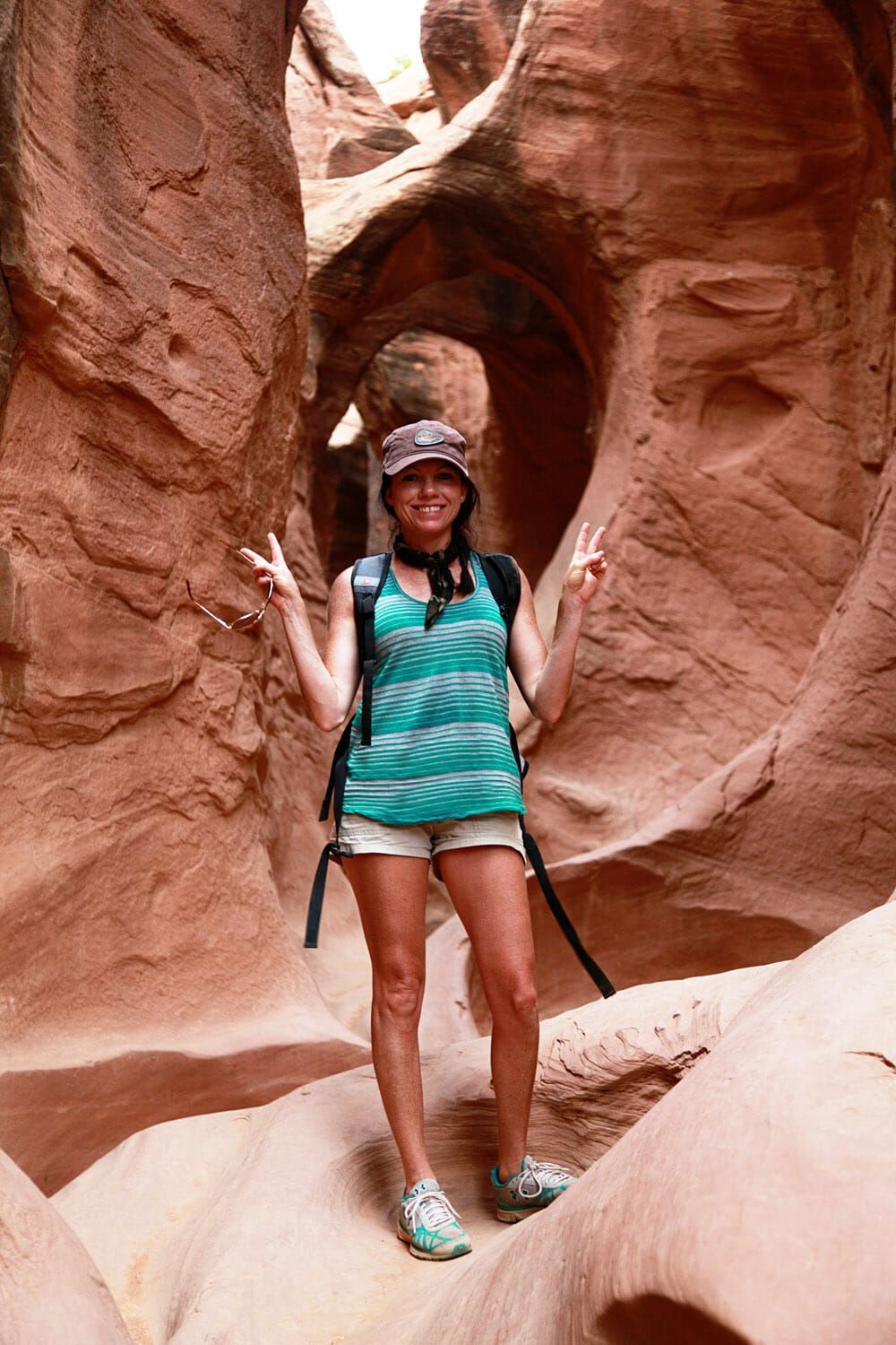
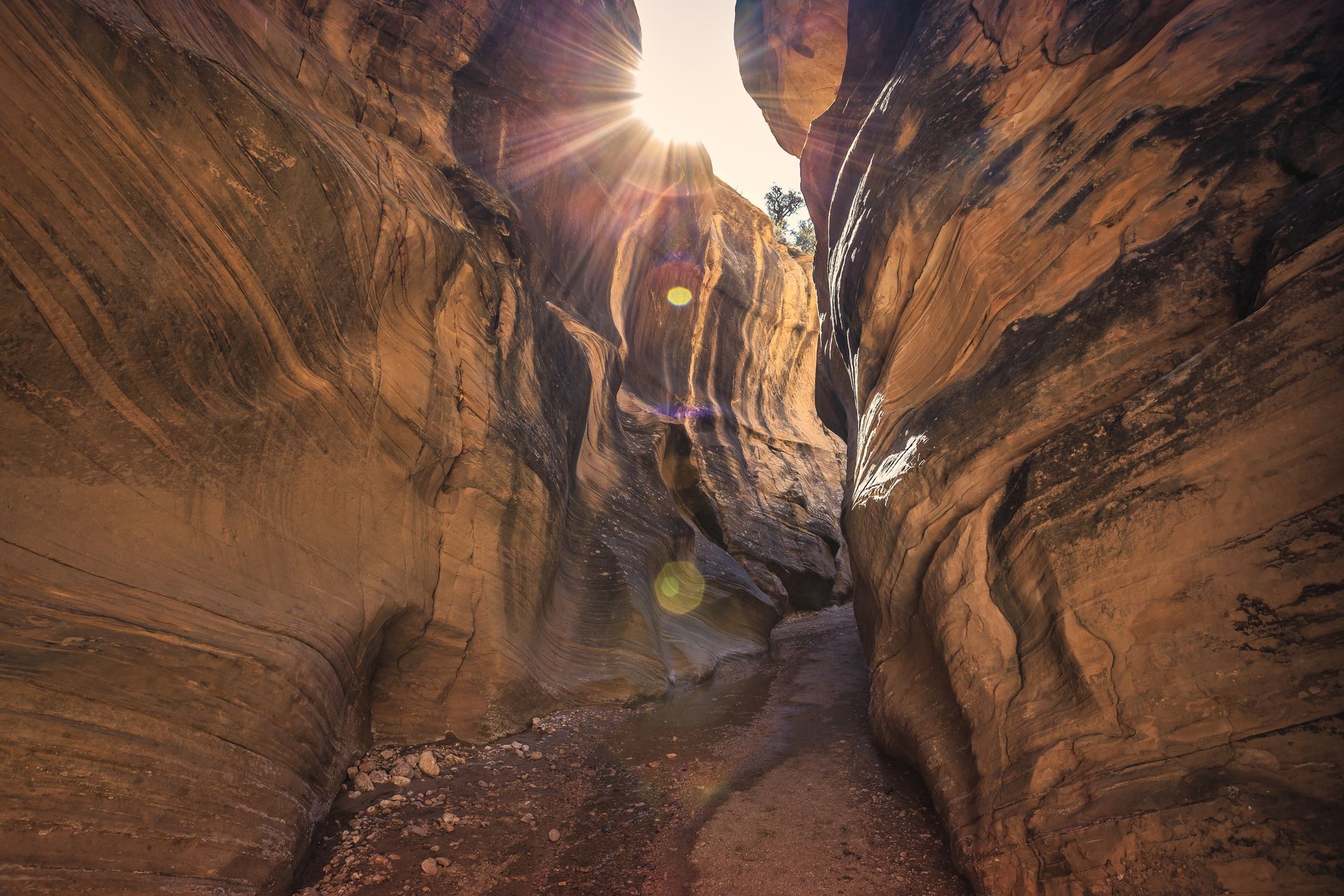
Peek-a-Boo and Spooky Gulch Slot Canyons
For those seeking a true slot canyon adventure, Peek-a-Boo and Spooky Gulch offer one of the most iconic hiking experiences in the Southwest. This popular loop combines two dramatically different canyons into a single, unforgettable hike. Peek-a-Boo features fun scrambling, twisting sandstone corridors, and colorful canyon walls. Spooky Gulch is famous for its incredibly narrow passages that squeeze between towering rock walls. Together they provide an authentic slot canyon experience unlike any other in the Southwest. This challenging route rewards adventurous hikers with unforgettable scenery and a deeper appreciation for how water and time shaped the landscape. This popular loop combines two dramatically different canyons into a single, unforgettable hike. Peek-a-Boo features fun scrambling, twisting sandstone corridors, and colorful canyon walls. Spooky Gulch is famous for its incredibly narrow passages that squeeze between towering rock walls. Together they provide an authentic slot canyon experience unlike any other in the Southwest.
Distance: Approximately 6-miles round trip as a loop. Allow 3 to 5 hours to complete.
Difficulty:
Moderate to Strenuous.
- What to Bring:
- Plenty of water (at least 2 to 3 liters per person)
- Sturdy hiking shoes with good traction
- Sun protection (hat, sunglasses, and sunscreen).
- Snacks or a packed lunch.
- A camera or smartphone for photos
- Swimsuit and towel if you plan to enjoy the pool beneath the falls.
- Lightweight layers for changing weather conditions.
- Downloaded trail maps or GPS navigation
Safety Precautions:
- Never enter either slot canyon if rain is forecast anywhere in the area. Flash floods can occur suddenly and are extremely dangerous.
- Peek-a-Boo requires a short, but steep scramble to enter, which may be difficult for some hikers.
- Spooky Gulch contains extremely narrow sections that may not be suitable for individuals with claustrophobia or larger body frames.
- Travel with a companion whenever possible. Let someone know your hiking plans before departing.
- Cell service is very limited or non-existent along the route.
- Road conditions on Hole-in-the-Rock Road can change rapidly after storms.
This hike is not recommended for young children, anyone uncomfortable in tight spaces, or visitors with mobility limitations.
Getting There:
The trailhead is located between Escalante and Boulder on the Scenic Byway 12 within the Calf Creek Recreation Area. A paved parking lot, restrooms, a campground, and a picnic area are at the beginning of the trailhead. The recreation area is approximately 15 miles east of Escalante and 11 miles west of Boulder.
Important Safety Information:
Never enter a slot canyon if rain is in the forecast, even if storms are many miles away. Flash floods can occur with little warning and can be extremely dangerous. Check weather conditions before your hike and avoid entering the canyon during periods of unsettled weather.
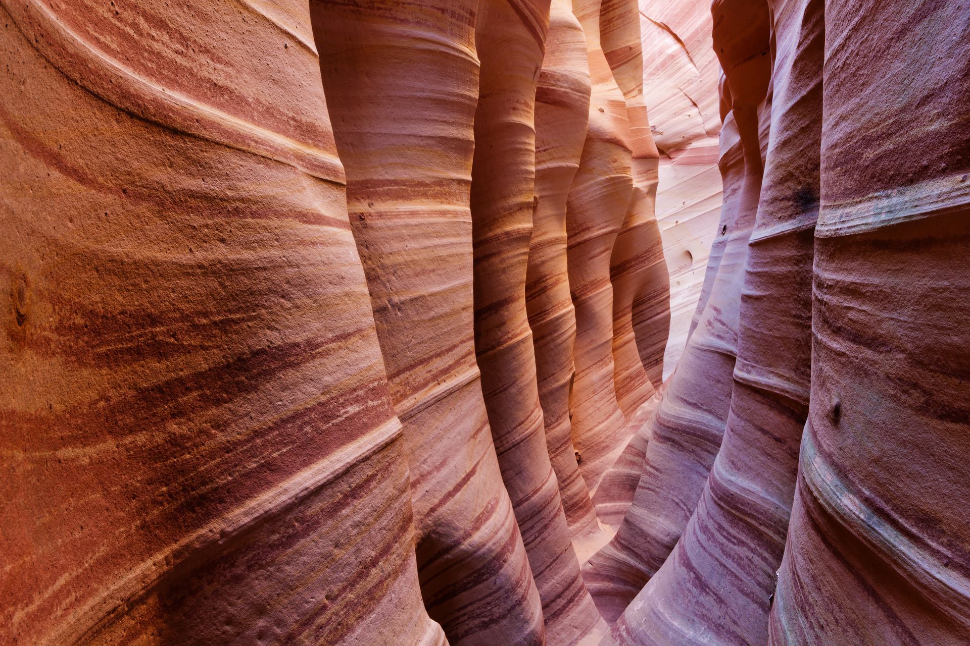
Zebra Slot Canyon
Named for its striking striped sandstone walls, Zebra Slot Canyon is one of the most photographed and recognizable slot canyons in the Escalante region. This adventurous hike begins with a scenic trek across open desert terrain before narrowing into a stunning passage of swirling red, pink, orange, and cream-colored rock. In some sections, the canyon becomes remarkably narrow, creating an exciting and unforgettable experience for adventurous hikers.
Though the hike is relatively short, visitors should prepare for uneven terrain, occasional water, and tight spaces. While the distance is manageable for many hikers, the route includes uneven slickrock, sandy washes, and very tight canyon sections that require scrambling and squeezing through narrow passages. Zebra Slot Canyons in not recommended for those who are uncomfortable in confined spaces.
Distance: Approximately 5.3 miles round trip. Allow 3 to 4 hours to complete.
Difficulty: Moderate to Strenuous
- What to Bring:
- Plenty of water (at least 2 liters per person)
- Sturdy hiking shoes with good traction
- Sun protection (hat, sunglasses, and sunscreen).
- Snacks or a packed lunch.
- A camera or smartphone for photos
- Downloaded trail map or GPS navigation.
- Lightweight layers for changing weather conditions.
Safety Precautions:
- Never enter either slot canyon if rain is forecast anywhere in the area. Flash floods can occur suddenly and are extremely dangerous.
- Water and mud are common in the narrow canyon section, especially after recent storms.
- The canyon narrows significantly may not be suitable for individuals with claustrophobia or larger body frames.
- Use caution on slickrock and uneven terrain.
- Travel with a companion whenever possible. Let someone know your hiking plans before departing.
- Cell service is very limited or non-existent along the route.
- Road conditions on Hole-in-the-Rock Road can change rapidly after storms.
This hike is not recommended for young children, anyone uncomfortable in tight spaces, or visitors with mobility limitations.
Getting There:
The trailhead is located approximately 7.8 miles down Hole-in-the-Rock Road, southeast of Escalante. Hole-in-the-Rock Road is a graded, dirt road that is generally suitable for most vehicles in dry conditions, but can become muddy and impassable after rain. The trail begins from a small parking area on the east side of the road.
Important Safety Information:
Never enter a slot canyon if rain is in the forecast, even if storms are many miles away. Flash floods can occur with little warning and can be extremely dangerous. Check weather conditions before your hike and avoid entering the canyon during periods of unsettled weather.
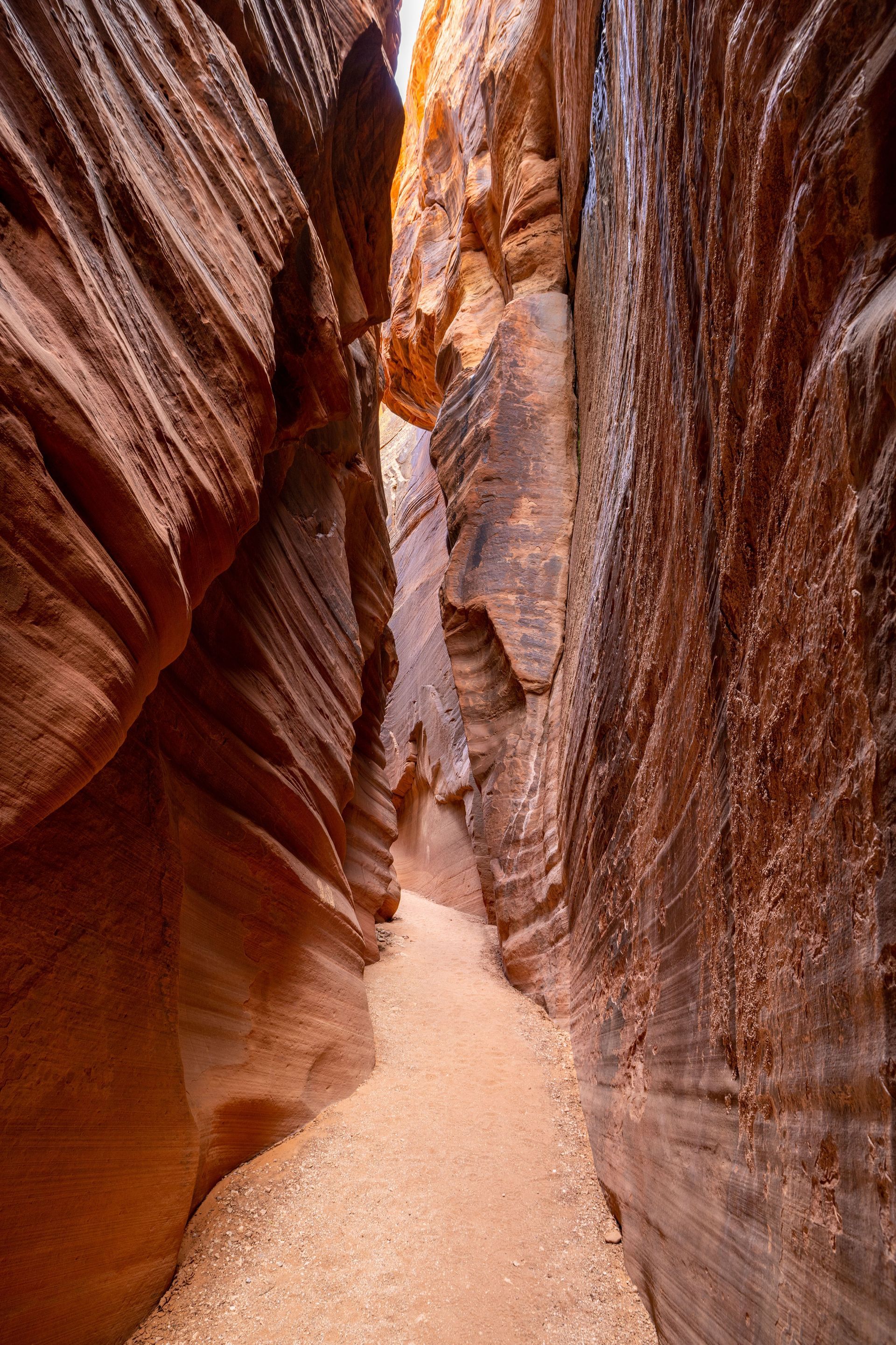
Willis Creek Slot Canyon
Willis Creek Slot Canyon offers one of the most accessible and family-friendly slot canyon experiences in Southern Utah. Unlike many slot canyons that require steep climbs or technical navigation, Willis Creek follows a gentle stream through towering sandstone walls, creating a beautiful and easy adventure for visitors of all ages. Along the way, you'll encounter narrow passages, colorful rock formations, small cascades, and peaceful canyon scenery that make this hike a favorite among families and photographers. Willis Creek Slot Canyon is 4 to 5 miles round trip (you can hike as far as you wish and turn around). Allow for 2 to 3 hours to complete the hike. Willis Creek Slot Canyon is an excellent choice for visitors looking to experience the beauty of a Utah slot canyon without the strenuous hiking often associated with more challenging routes.
Distance: 4 to 5 miles round trip. Allow 2 to 3 hours to complete.
Difficulty: Easy
What to Bring:
- Plenty of water (at least 1 to 2 liters per person)
- Comfortable hiking shoes or water-resistant footwear.
- Sun protection (hat, sunglasses, sunscreen etc).
- Light snacks or packed lunch.
- Camera or smartphone.
- Light jacket depending on weather.
Safety Precautions:
- Expect to cross the creek multiple times and get your feet wet.
- Avoid the canyon if rain is forecast anywhere in the drainage area due to flash flood risk.
- Be aware that rocks near the water can be slippery.
- Cell service is limited, so dowload maps before leaving town.
Getting There:
The trailhead is located along Skutumpah Road, about 15 miles south of Cannonville, Utah. From Cannonville, head south on Kodachrome Road, which eventually becomes Skutumpah Road. The road is mostly well-graded dirt and typically passable for most vehicles in dry conditions, but it can become muddy and difficult after rain. There is a small, unmarked parking area near a cattle guard where the trail begins. GPS coordinates for the trailhead are approximately 37.50 degrees N, 112.2205 degrees W.
Big Horn Slot Canyon
Big Horn Slot Canyon is one of the most accessible and enjoyable slot canyon adventures near Escalante. Often paired with nearby Zebra Slot Canyon, Big Horn offers a less restrictive experience with wider passages, beautiful sandstone walls, and plenty of opportunities to explore the unique geology of the Grand Staircase-Escalante National Monument. The canyon's twisting corridors, sculpted rock formations, and ever-changing colors make it a favorite for families, photographers, and hikers looking to experience a slot canyon without the extremely tight squeezes found in some nearby canyons.
Distance: Approximately 4 to 5 miles round trip. Allow 2 to 4 hours to complete.
Difficulty: Moderate
What to Bring:
- Plenty of water (at least 2 liters per person)
- Sturdy hiking shoes with good traction
- Sun protection (hat, sunglasses, and sunscreen).
- Snacks or a packed lunch.
- Camera or Smartphone.
- Downloaded trail map or GPS navigation.
- Lightweight layers for changing weather conditions.
Safety Precautions:
- Summer temperatures can be extremely hot; start early and carry extra water.
- Stay on designated trails to protect fragile desert soils and vegetation.
- Watch for wildlife, including rattlesnakes during warmer months.
- Cell service may be limited in parts of the park.
- Afternoon thunderstorms can develop quickly during monsoon season.
Getting There:
Just 30 minutes from Slot Canyons Inn, Kodachrome Basin offers breathtaking scenery, fewer crowds than many nearby parks, and countless opportunities to experience the beauty and serenity of Southern Utah's canyon country.
Kodachrome Basin State Park
Known for its colorful sandstone spires, sweeping desert vistas, and remarkable geologic formations, Kodachrome Basin State Park is one of Southern Utah's hidden gems. Named after the vibrant Kodak film, the park features more than 60 towering sandstone chimneys called sedimentary pipes, creating a landscape unlike anywhere else in the Southwest. Scenic drives, hiking trails, wildlife viewing, photography, horseback riding, and dark night skies make Kodachrome Basin a wonderful destination for visitors seeking both adventure and tranquility.
Distance: Multiple trail options ranging from short walks to hikes of 6+ miles. Allow for 2 hours to a full-day, depending on activities.
Difficulty: Easy to Moderate
What to Bring:
- Plenty of water (at least 2 to 3 liters).
- Sturdy walking or hiking shoes.
- Sun protection (hat, sunglasses, and sunscreen).
- Snacks or a picnic lunch.
- Camera or binoculars.
- Layers for changing weather conditions.
Safety Precautions:
- Summer temperatures can be extremely hot; start early and carry extra water.
- Stay on designated trails to protect fragile desert soils and vegetation.
- Watch for wildlife, including rattlesnakes during warmer months.
- Cell service may be limited in parts of the park.
- Afternoon thunderstorms can develop quickly during monsoon season.
Getting There:
Just 30 minutes from Slot Canyons Inn, Kodachrome Basin offers breathtaking scenery, fewer crowds than many nearby parks, and countless opportunities to experience the beauty and serenity of Southern Utah's canyon country.
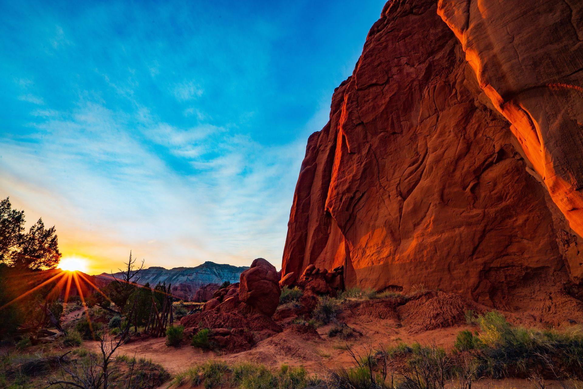
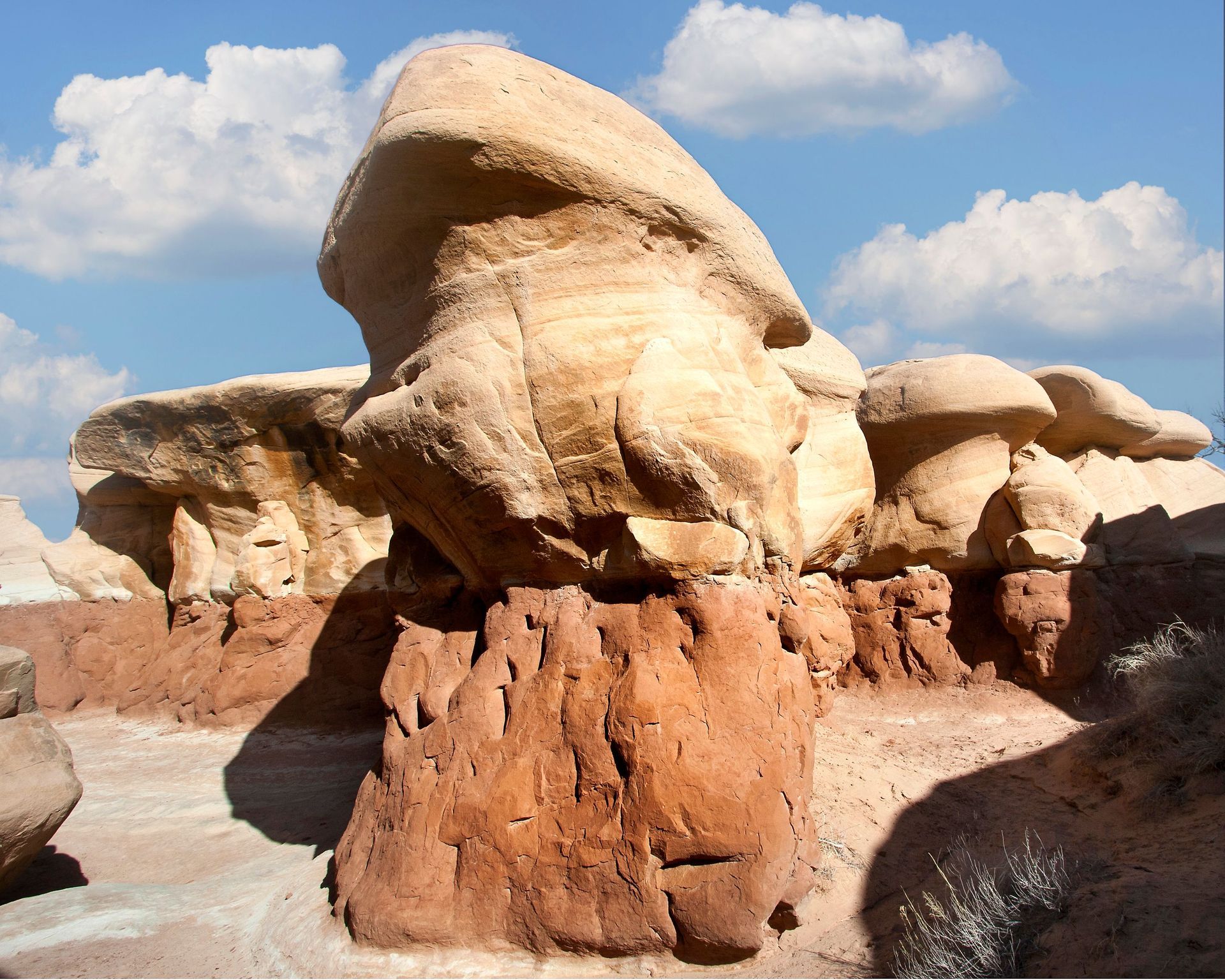
Devil's Garden
Devil's Garden is one of the most fascinating and photogenic destinations in Grand Staircase-Escalante National Monument. This remarkable natural area features. a whimsical landscape of sandstone arches, towering hoodoos, fins, and sculpted rock formations shaped by millions of years of wind and water erosion. Visitors can wander among these unique formations, discovering hidden passageways, natural arches, and breathtaking desert vistas around every turn. The open nature of the area allows exploration at your own pace, making it a favorite destination for photographers, families, and adventurers alike.
Distance: Variable; most visitors walk 1 to 2 miles exploring the area. Allow 1 to 3 hours to complete.
Difficulty: Easy
What to Bring:
- Plenty of water (at least 2 to 3 liters).
- Sturdy walking or hiking shoes.
- Sun protection (hat, sunglasses, and sunscreen).
- Camera or Smartphone.
- Snacks or a picnic lunch.
- Layers for changing weather conditions.
Safety Precautions:
- There are no designated trails through much of the area, so watch your footing on uneven sandstone surfaces.
- Stay back fro cliff edges and elevated rock formations.
- Summer temperatures can be extremely hot. Carry plenty of water and avoid the hottest part of the day.
- Cell service is limited or unavailable.
- Do not climb on delicate archs or fragile rock formations.
- Leave all natural features undisturbed and practice Leave No Trace principles.
Getting There:
From Escalante, travel southeast on Hole-in-the-Rock Road for approximately 12 miles. Turn left onto the signed Devil's Garden access road and continue a short distance to the parking area. Hole-in-the-Rock Road is a graded dirt road that is generally suitable for most vehicles in dry conditions but can become muddy and difficult to travel after rain.